Talk:Canada–United States border
| This is the talk page for discussing improvements to the Canada–United States border article. This is not a forum for general discussion of the article's subject. |
Article policies
|
| Find sources: Google (books · news · scholar · free images · WP refs) · FENS · JSTOR · TWL |
| Archives: 1 |
| This article is rated B-class on Wikipedia's content assessment scale. It is of interest to the following WikiProjects: | ||||||||||||||||||||||||||||||||||
| ||||||||||||||||||||||||||||||||||
Wiki Education Foundation-supported course assignment
[edit]![]() This article was the subject of a Wiki Education Foundation-supported course assignment, between 18 August 2021 and 18 December 2021. Further details are available on the course page. Student editor(s): Greece12.
This article was the subject of a Wiki Education Foundation-supported course assignment, between 18 August 2021 and 18 December 2021. Further details are available on the course page. Student editor(s): Greece12.
Above undated message substituted from Template:Dashboard.wikiedu.org assignment by PrimeBOT (talk) 16:37, 16 January 2022 (UTC)
the 49° line
[edit]
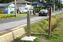
"lies on the 49th parallel north" is not quite accurate; I prefer "lies along". The border is defined not by the abstract latitude but by markers like this obelisk, which wobble from 49° by a few hundred metres each way; see 49th parallel north#As border. It follows that the Northwest Angle is not the only bit north of 49°. —Tamfang (talk) 06:06, 2 April 2023 (UTC)
- Don't "lie on" and "lie along" mean the same thing? How about "follows the 49th parallel of north latitude subject to small deviations"? WmDKing (talk) 19:51, 9 May 2023 (UTC)
- To me at least, "on the line" is a much tighter constraint than "along the line". But how about "approximates"? —̦Tamfang (talk) 03:34, 18 May 2023 (UTC)
Describing Current Border
[edit]The article would be made more useful if it began with at least a general description of the geographical location of the border. The detailed description of the border is given later and is subdivided by provinces or regions beginning on the west coast. However, as the delineation of the Canada-U.S. border proceeded from east to west, it would make more sense to present the description of its route in the same fashion. This was the approach taken in the Treaty of Paris and I would surmise though I am not certain, in most of the other documents which defined the border. This being the case, the description of the physical border from east to west would better enable the reader to relate that process to related historical events. WmDKing (talk) 22:07, 27 April 2023 (UTC)
- Curiously the markers along the 49° line are numbered from the west! —Tamfang (talk) 03:36, 18 May 2023 (UTC)
pandemic
[edit]Now that the Covid closure is over, I think that section can be shorter, with several sentences collapsed to The closure was extended 15 times, but gradually loosened in the summer of 2021, with all pandemic-related restrictions finally lifted on [date].
—Tamfang (talk) 07:39, 3 May 2024 (UTC)
- B-Class Canada-related articles
- Mid-importance Canada-related articles
- B-Class Geography of Canada articles
- Mid-importance Geography of Canada articles
- All WikiProject Canada pages
- B-Class United States articles
- Mid-importance United States articles
- B-Class United States articles of Mid-importance
- WikiProject United States articles
- B-Class International relations articles
- Mid-importance International relations articles
- WikiProject International relations articles


